It is spring break season in the Natural State. The perfect time to explore the great outdoors, and there is no better way than hiking. With a network of over 500 natural surface trails throughout 17 million acres of forest land, 3 national forests, 52 state parks, and 7 National Park Service sites, Arkansas is a hiker’s paradise.
Given so many choices, it can be intimidating deciding where to begin. To help jump start your hiking adventure, we’ve rounded up a list of trails for consideration, beginning with easy trails located in the River Valley, then branching out to several others. The more challenging trails will reward your efforts with unique natural features or stunning views.
The Big Cottonwoods Trail and Box Turtle Loop Trail
Location: Fort Smith, AR
Mileage: 5 miles
Difficulty: Easy
Directions: Park your vehicle at Power’s Port Canoe Access on Riverfront Drive. Continue over the levee and look for the dirt path to the left. This is the beginning of the Big Cottonwoods Trail. It is a relatively new trail, constructed by volunteers. At the time of this writing, the trail entrance was not marked.
Although just outside the busy downtown area, this hike through a forest of box elder and cottonwood trees offers great opportunities for viewing waterfowl, deer, and beavers. A mile into the hike the trail passes remnants of an old metal bridge, once used by farmers to work this fertile river bottom land. You have the option of following a pathway under the bridge to reach Box Turtle Loop Trail, or to continue the Cottonwoods Trail. If the water level is too high to safely make the crossing, continue the Cottonwoods to join the Box Turtle Loop at the southern intersection.
Lake Greenwood Trails
Location: Greenwood, AR
Mileage: 5 miles
Difficulty: Easy
Directions: The Lake Greenwood parking lot is located off Highway 10, east of the downtown square, then 1.8 miles south on Mt. Harmony Road.
There are approximately three miles of trail on each side of the parking lot. The entrance to the East Loop Trail crosses a historic 1931 pony truss bridge, relocated from Hope, Arkansas. The trail meanders along the shoreline, past an inviting picnic pavilion and the remnants of an interesting old iron bridge. It then crosses several wooden bridges expertly constructed by Greenwood’s Scout Troop 54. On the opposite side of the parking lot, the trail routes hikers along the lakeshore then over the backbone of a ridge. Pause a moment at the bench mounted at an overlook into the surrounding valley.
Glory Hole
Mileage: 2 miles roundtrip
Difficulty: Moderate
Directions: Drive 5.7 miles east of Fallsville, AR on Highway 16/21. There is a small parking area for the trail on the right side of the road.
The hike follows an old, abandoned logging road for a quarter of a mile, before turning right on a well-defined pathway. This short hike leads to one of the most unique natural wonders in the state. At one time, the drainage you follow flowed over the ledge of a bluff shelter to create what I’m sure was a beautiful 30-foot waterfall. But over centuries of constant wear, the water bore a large hole through solid rock, to drop directly into the shelter below. Truly amazing. View the smoothly polished stone at the top of the hole, then scamper down the right side of the bluff line to witness the stream of water gushing through. I have seen it with the column of water completely frozen. Truly, one of Mother Nature’s finest creations.
Buffalo River Trail, Ponca to Kyles Landing
Mileage: 10 miles
Difficulty: Moderate/Difficult
Directions: At the northern end of historic Boxley Valley, leave your vehicle in the parking area just south of the intersection of Highways 43 and 74. Then walk across the low-water bridge over the Buffalo River and turn left to begin your Buffalo River Trail (BRT) adventure.
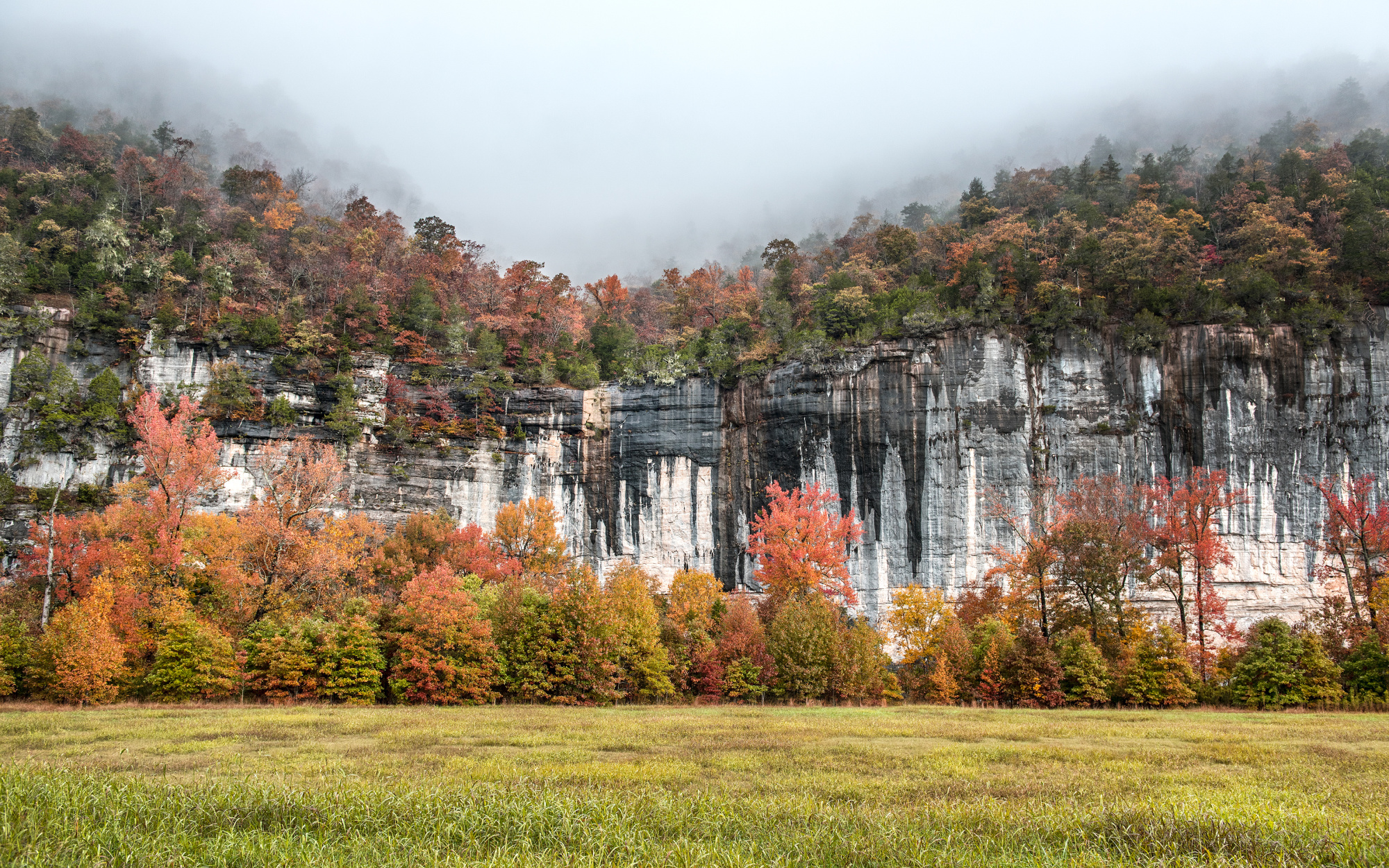
The 37-mile BRT is the most scenic hiking trail in the state. The section from Ponca to Kyles offers more scenic views of the waterway than any other stretch along the river. Tim Ernst’s photo of Roark Bluff, taken from a vista just east of Steel Creek Campground, was used for a poster commemorating the twenty-fifth anniversary of the Buffalo becoming the nation’s first National River. If you have the time to hike the entire trail, I highly recommend it. But for a day hike, you cannot go wrong with this section of trail. The hike can be shortened 2 miles by beginning at Steel Creek Campground.
Hemmed-In Hollow Falls
Mileage: 5 miles roundtrip
Difficulty: Difficult
Directions: On Highway 43, 10 miles north of Ponca, AR, turn right on the gravel road directly across from the Compton Post Office. Next, turn right at the first intersection, then drive less than 1 mile before turning right once again. The Compton Trailhead parking lot will be on your left.
At 209 feet, this is the tallest waterfall between the Appalachians and the Rockies. The view from the trail offers scenic, panoramic views of the surrounding mountains and the upper section of the falls. Stand at the base of the falls to watch the stream of falling water dancing about in the whisking wind sweeping across the bluff wall.
The hike received a difficult rating due to the 1,300-foot elevation gain on the return hike. If you have time on your return, take the short spur trail to visit Wild Vic’s cabin.


